Automate Your Roadway Inspections Without Buying a Single Piece of Hardware
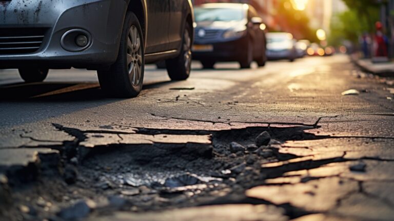
Use passive AI to identify potholes, safety hazards, and asset damage with 97% accuracy—delivered as a service.
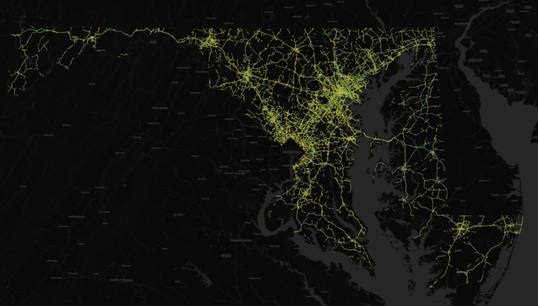
State and local DOTs are facing record-high inflation and $300M+ budget deficits. Blyncsy helps you do more with less by turning existing vehicle data into a living map of your infrastructure. No lidar rigs. No manual patrols. Just the data you need to fix your roads faster.
Trusted by State DOTs and Cities Nationwide


Why Blyncsy
Your maintenance budget is eroding, and staff vacancies are at an all-time high.
Undetected defects lead to multimillion-dollar liability claims and safety hazards that put lives at risk.
Every minute you spend manually “finding” problems is a minute you aren’t “fixing” them. In New York City alone, road defects have cost $138M in legal settlements.
The solution
Network-Wide Visibility at the Speed of Reality
Blyncsy leverages imagery from over 1.5 million vehicles already on your roads today to provide a real-time, objective health score for every mile of your network.

Automated Asset Inventory
Maintain a location-aware record of guardrails, signs, streetlights, and other roadway assets with zero manual field time.

Proactive Pavement Management
Detect potholes and pavement cracking before they become expensive reconstructions. Automate your HPMS and MIRE reporting.

Night-Time Safety Analysis
The only solution that monitors sign retroreflectivity and paintline visibility at night, helping you maintain compliance with federal regulations.
Environmental Protection
Identify vegetation encroachment and debris to prevent flooding and infrastructure damage, all while cleaning the air of unnecessary carbon emissions.
What we Offer
Solutions for your Challenges
Blyncsy provides the advanced intelligence to break the costly, reactive cycle of road maintenance, helping you address issues early to stretch your limited budget and improve public safety.
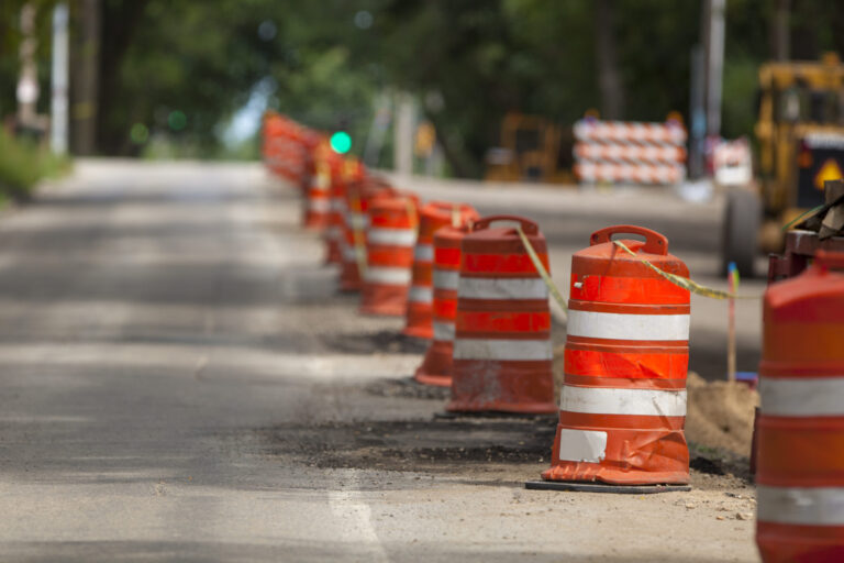
Remote Work Zone Monitoring
Ensure work-zone safety and compliance with high-frequency, automated visual monitoring and confirmation.
Pavement Condition Analysis
Automate your pavement condition analysis for accurate PASER scoring, defect detection, and streamlined HPMS/MIRE reporting.

Asset Inventory and Condition Assesment
Streamline the creation of a complete, MUTCD-compliant asset inventory while automatically assessing condition and detecting damage.

Critical Safety Assets
Proactively monitor the condition and presence of essential infrastructure like guardrails, street lights, and safety barriers to ensure they are functional when needed most.
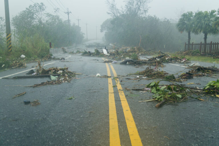
Disaster Recovery
Accelerate post-disaster recovery by leveraging historical imagery and automated damage assessments to secure emergency funds faster.
Client Success Stories
Discover the real-world impact Blyncsy is delivering for transportation leaders and their communities.
Alabama Department of Transportation
ALDOT leverages Blyncsy to improve statewide asset surveys and strengthen data-driven maintenance planning.
City of Plano, TX
“Blyncsy’s inventory and detection capabilities have the potential to be really powerful when used on a wide scale to identify issues like streetlight outages and other potential safety concerns.”
— Chad Ostrander, Senior Traffic Engineer, City of Plano
Hawaii Department of Transportation
Bentley’s Blyncsy solution uses AI to help the Hawaii Department of Transportation to spot roadway damage faster, prioritize repairs, and keep drivers safe.
Real world results
We deliver what matters most to you and your residents
Blyncsy doesn’t just have fancy technology that looks great on paper. Our automated AI solution turns crowdsourced dash camera imagery into actionable insights, allowing you and your teams to manage and maintain your infrastructure more efficiently and at a much lower cost.
From potholes to damaged guardrails, missing signs and faded crosswalks, Blyncsy’s automated solutions support your efforts to maintain safe roadways while allowing you to deploy your human assets more effectively.
Your maintenance and operations teams are better served fixing problems instead of finding them. Blyncsy turns 1.5 million vehicles already on your roads into a 24/7 data collection fleet, keeping your teams out of harm’s way.
Imagine optimizing your maintenance budgets on repairs, not finding problems. Blyncsy can help you significantly lower your costs to maintain your infrastructure assets, allowing you to do more with less.
For every maintenance vehicle you can take off the roads, you’re removing over 23,000 pounds of carbon emissions from the atmosphere, each year. That means cleaner air and less wear-and-tear on your vehicle fleet.
Strategic Impact
Build a More Manageable and More Resilient Transportation Network
Sustainability
Reduce Carbon Emissions
By eliminating dedicated survey vehicles, our partners like Hawaii DOT saved 23,000 lbs of CO2.
Asset Lifespan
Predictive Preservation
Catching minor cracking early allows for cheap preservation (seal coating) instead of expensive reconstruction, extending the life of your roads by years.
Safety
Support Vision Zero Goals
Automatically detect faded crosswalks and missing school zone signs to protect vulnerable road users.
How it Works
From Data to Work Orders in 3 Simple Steps
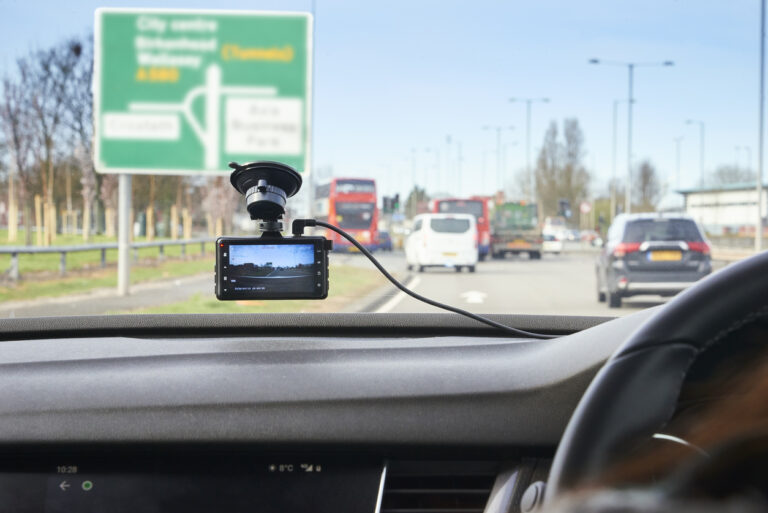
We aggregate imagery from existing commercial fleets already driving your roads.
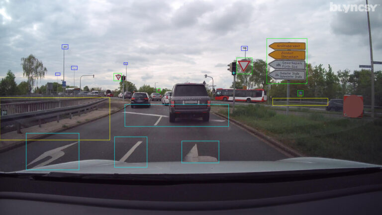
Our automated platform uses computer vision and Google Vertex AI to detect assets and defects with engineering-grade precision.
Results are delivered via OGC APIs or direct integrations into your existing GIS and maintenance software.
FAQ
Your Most Common Questions, Answered.
What is Blyncsy and how does it fundamentally change DOT operations?
Blyncsy is the industry leader in providing intelligent roadway insights, automated asset management, and near real-time status updates of road infrastructure for local governments and state departments of transportation. At its core, the platform is an artificial intelligence service that applies computer vision and machine learning to commonly available imagery to identify maintenance issues across vast roadway networks. Historically, DOTs relied on “clipboard and truck” surveys—expensive, manual, and often subjective field investigations that provided only a snapshot in time of a road’s condition. Blyncsy disrupts this model by turning any vehicle on the road into a 24/7 detection network, effectively acting as a “force multiplier” for existing department experts. By automating the discovery of problems, it allows DOT crews to stop looking for issues and start fixing them, shifting the operational paradigm from a reactive stance to a proactive, evidence-based strategy.
How does the platform achieve data collection without requiring new hardware installations?
What level of accuracy and reliability can agencies expect from Blyncsy AI?
In what ways does Blyncsy directly impact DOT budgets and fiscal efficiency?
How does the technology specifically address the safety of vulnerable road users?
What are the environmental and sustainability implications of moving to an automated system?
Stop Managing Sensors. Start Managing Your Assets.
Join the agencies in Utah and across the US that are automating their workflows and protecting their budgets with Blyncsy.

