Active Projects | Hawaii Department of Transportation
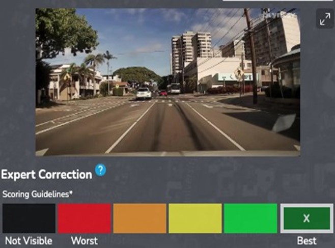
Hawaii DOT switched to Blyncsy to automate roadway condition assessment and damage detection
From debris and vegetation encroachment to guardrail damage detection, Blyncsy is helping Hawaii Department of Transportation maintain a safe and pristine road network for its residents, tourists, and the most vulnerable road users.
95%
reduction in manual surveys
96%
Potential savings using Blyncsy compared to manual or LiDAR inspections
23,286
pounds of carbon emissions saved per vehicle per year
Region
Hawaii
Country
US
Agency
Department of Transportation

Solving Unique Challenges
The state of Hawaii has numerous unique challenges including aging infrastructure, weather patterns, and a disjointed roadway system. Using Blyncsy, Hawaii DOT conducted a project to utilize machine vision and dashcam imagery to increase situational awareness and streamline the road maintenance process.
Road Maintenance in Hawaii
Road maintenance in Hawaii is a critical issue that requires continuous attention and investment from the Hawaii Department of Transportation (HDOT). Despite Hawaii’s beautiful scenery and generally mild climate, the state has seen a high number of roadway fatalities in recent years.
According to data from the National Highway Traffic Safety Administration, there were 117 traffic-related fatalities in Hawaii in 2022, a significant increase from the 94 fatalities recorded in 2021.
HDOT also faces a number of unique challenges when it comes to road maintenance including the state’s aging infrastructure. Many of Hawaii’s roads were built decades ago and are now in need of significant repair and replacement. Additionally, Hawaii’s location in the Pacific Ocean makes it vulnerable to extreme weather events, such as hurricanes and flooding, which can damage roadways and make them unsafe for travel, and the separate geography of the 4 main islands can cause issues as well.
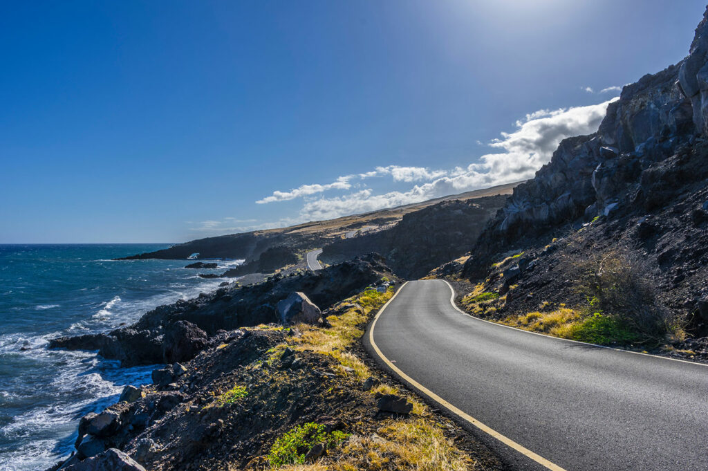
In 2022, the state of Hawaii and HDOT set out to determine the extent to which manual drives, increased CCTV coverage, and manual roadway surveys in Hawaii can be replaced and automated using crowdsourced dashcam imagery and machine learning. The project encompasses 1,013 miles of roadway, which is the majority of DOT public roads in the state, and covers the 4 main islands of Hawaii (Maui, Hawaii, Kauai, and Oahu).
These roadways cover a diverse set of locations including densely populated cities, rural roads, and everything in between. This highlighted the need for comprehensive dashcam footage, and advanced machine learning models to handle the wide variety of background scenery, from nearly desert to lush forest.
To address the needs of HDOT Blyncsy provided crowdsourced dashcam imagery from dashcams on Hawaii’s roadways along with machine learning models to deliver thousands of on road images per mile and automatically survey roadways for multiple different assets each week. Specifically these surveys provided information on:
- Striping visibility
- Barrel detection
- PASER (Pavement Surface Evaluation and Rating System)
- Guardrail damage detection
- Roadway vegetation encroachment
- Stop signs
- Debris
- Cracking
Machine Vision for Roadway Maintenance
Traditionally organizations in charge of roadway maintenance have relied on a series of manual processes to ensure the condition of roads is up to the standards of road users. These can be roughly summarized as:
- What is wrong – What is the state of the roadways
- Road surveys – Determining the specifics of any issues, and enabling a plan for remediation
- Road maintenance – Fixing the issues
Utilizing machine vision for roadway maintenance allows organizations to partially or wholly replace the first two steps with automated processes, greatly reducing the cost, manual work, and environmental impact. Due to the ease of adoption and low marginal cost, they can also expand the scope of the first two steps to better determine the extent of the problems they have, and the best place to allocate resources for road maintenance.
Blyncsy is a complete solution to implement machine vision for any roadway nearly instantly. Blyncsy sources dashcam imagery for any road in the US, stores and archives the images for quick access, and uses cutting edge machine learning algorithms to analyze imagery for any number of common or uncommon issues. All of this is then easily accessible via web interface, or open-geospatial (OGC) compliant Web Map Service (WMS) and Web Feature Service (WFS).
Guardrail Damage Repair, Debris Removal, and Vegetation Removal
One well known issue in roadway maintenance is that typical roadway users rarely report problems. While issues like debris in the road, damaged roadway infrastructure, or vegetation blocking the road are often a problem for road users, they often believe others will report it, or that Department of Transportation personnel are already aware of it.
Utilizing Blyncsy, all roadway maintenance issues can be identified, deduplicated, and verified as fixed. In Hawaii multiple issues were fixed due to Blyncsy identifications, some examples are below. In addition, this data was reported to different divisions in their preferred format, smoothly integrating with existing known issues, roadway user reports, and existing workflows.

Road and Striping Condition
Roadway and Striping preventative maintenance is vital in preserving the useful lifespan of roads and keeping them safe for both drivers and pedestrians alike. It can help identify and address minor issues before they become major problems, resulting in increased costs to repair versus preventative maintenance.
Blyncsy provided data on road conditions, the industry-standard PASER (Pavement Surface Evaluation and Rating System) score, and paint line conditions on a weekly basis. This allowed HDOT to monitor changes and degradation over the lifespan of the project.

Cost Savings
Utilizing Blyncsy machine vision for roadway maintenance saved HDOT approximately $250,000 per year compared to weekly manual surveys. Cost savings are calculated as the hourly wage, mileage costs, and vehicle maintenance costs for HDOT to have maintenance personnel drive all of the same roadways each week.
Additionally, Blyncsy on average identified 930 active issues per week (Guardrail damage, debris, and vegetation encroachment). The estimated savings compared to manually cataloging and entering these issues is approximately $320,000.
Finally, compared to traditional methods to gather paint line visibility and PASER scoring, utilizing Blyncsy produced weekly updated information, and saved approximately $300,000. The table below compares the average costs of using Blyncsy vs manual vs Lidar image collection for each Centerline Mile(CLM) and layer update.
Success in Hawaii
Throughout this project, HDOT has gained a significant increase in insights available to them on the state of the roadway system in Hawaii. These insights have been used to remediate real issues on roadways that otherwise may not have even been reported, let alone fixed. Additionally, Hawaii Department of Transportation was able to verify the fix did indeed occur, in the correct location. This can often be an issue with contractors who may not correctly fix an issue, or even potentially fix an issue in another location.
This pilot project has already resulted in cost savings compared to traditional methods, as outlined above. In terms of roadway maintenance, according to the Hawaii Statewide Transportation Asset Management Plan, roadway preservation tactics cost in the realm of $30k – $500k per lane-mile compared to reconstruction, which costs $1.1 million – $2.3 million per lane-mile. By proactively identifying issues and resolving them, HDOT will be able to realize these additional savings moving forward.
While Blyncsy will never fully remove the need to manually survey, it can reduce the need for manual surveys by up to 95%. By utilizing dashcam images from drivers already out on the roads to gain real-time and accurate insights Blyncsy greatly reduces the need to manually survey, saving agencies up to 23,286 pounds of carbon emissions per work vehicle per year.
95%
Reduction in manual surveys
23,286
pounds of carbon emissions saved per vehicle per year
96%
Potential savings using Blyncsy compared to manual or LiDAR inspections
97%
possible savings with roadway preservation vs reconstruction
Explore More Active Projects
Port Authority of New York and New Jersey

City of Plano
Alaska Department of Transportation
Hawaii Department of Transportation