Canada National Highway System Roadway Safety and Maintenance Conditions
Blyncsy empowers the Canadian Transportation Agency and regional Ministries of Transportation with the ability to monitor and compare—in near real-time—the status of any major highway with their existing data for more informed decision-making.
“By extending our mapping capabilities into Canada and enhancing the U.S. interstate map, we’re reinforcing our commitment to providing state, provincial, and local agencies with the actionable data they need to maintain safer, more efficient road networks. Our vision is to democratize access to roadway data, helping agencies worldwide make informed decisions that save time, reduce costs, and improve safety for everyone.”
Mark Pittman, Founder
Blyncsy
Blyncsy is Democratizing our Data
Comprehensive public map of current roadway safety and maintenance conditions across Canadian highways
Building on the success of its previously published map of all interstate highways in the continental U.S., Blyncsy, a Bentley Systems, Incorporated (Nasdaq: BSY) company, has expanded its coverage to include thousands of miles of Canadian highways and introduced new detection layers for enhanced roadway safety and maintenance insights.
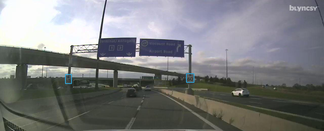
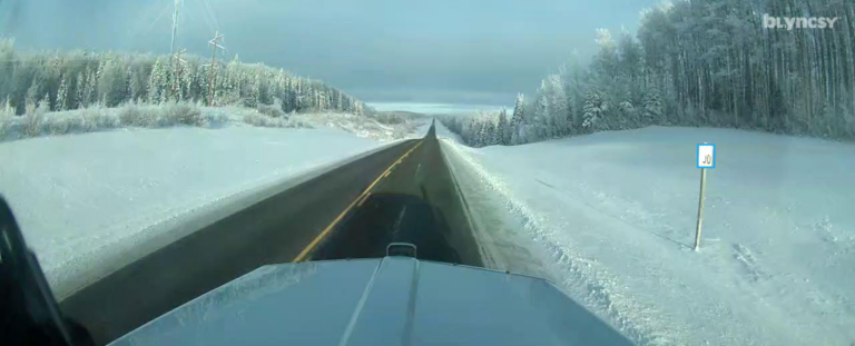
This map leverages Blyncsy’s powerful AI image analysis tools and crowdsourced dash camera imagery from over one million vehicles to detect and report on key roadway features and hazards in near-real time. Transportation agencies across North America can now accelerate their digital infrastructure plans and access data on critical issues such as guardrail damage, missing signage, and improper road striping, as well as additional detection layers designed to further improve road safety and operational efficiency.
The Canadian expansion is part of Blyncsy’s larger mission to support the digital infrastructure movement and enable proactive roadway maintenance. The data is delivered through an open API, providing an infinitely scalable, cost-effective alternative to traditional manual inspection methods such as LiDAR or physical road crew dispatches.
By expanding its geographical reach and technological capabilities, Blyncsy is setting a new standard for open, accessible roadway data, supporting a global digital infrastructure vision for safer, smarter transportation infrastructure.
Scroll and zoom in on the map to view individual areas. Select or deselect the layers along the left side menu to view specific detections.
This map was developed for marketing purposes only, and a representation of what is possible when you partner with Blyncsy for roadway management and asset inventory projects of all sizes.
Copyright ©2024 Blyncsy, Inc. A Bentley Systems Company.
Blyncsy
Comparison
Competition
Want to get a custom overview of your managed roads?
Schedule a demo now
Ready to spend more of your time and budget on fixing problems, rather than finding them? Request some time with our team and we’ll walk you through how Blyncsy works, what makes us unique, and why so many local and state transportation agencies are turning to our automated AI technology to create a safer, more efficient, and more equitable transportation network.

