Washington D.C. Roadway Safety and Maintenance Conditions
Blyncsy empowers cities large and small across the country with the ability to monitor and compare—in near real-time—the status of roadways with their existing data for more informed decision-making.
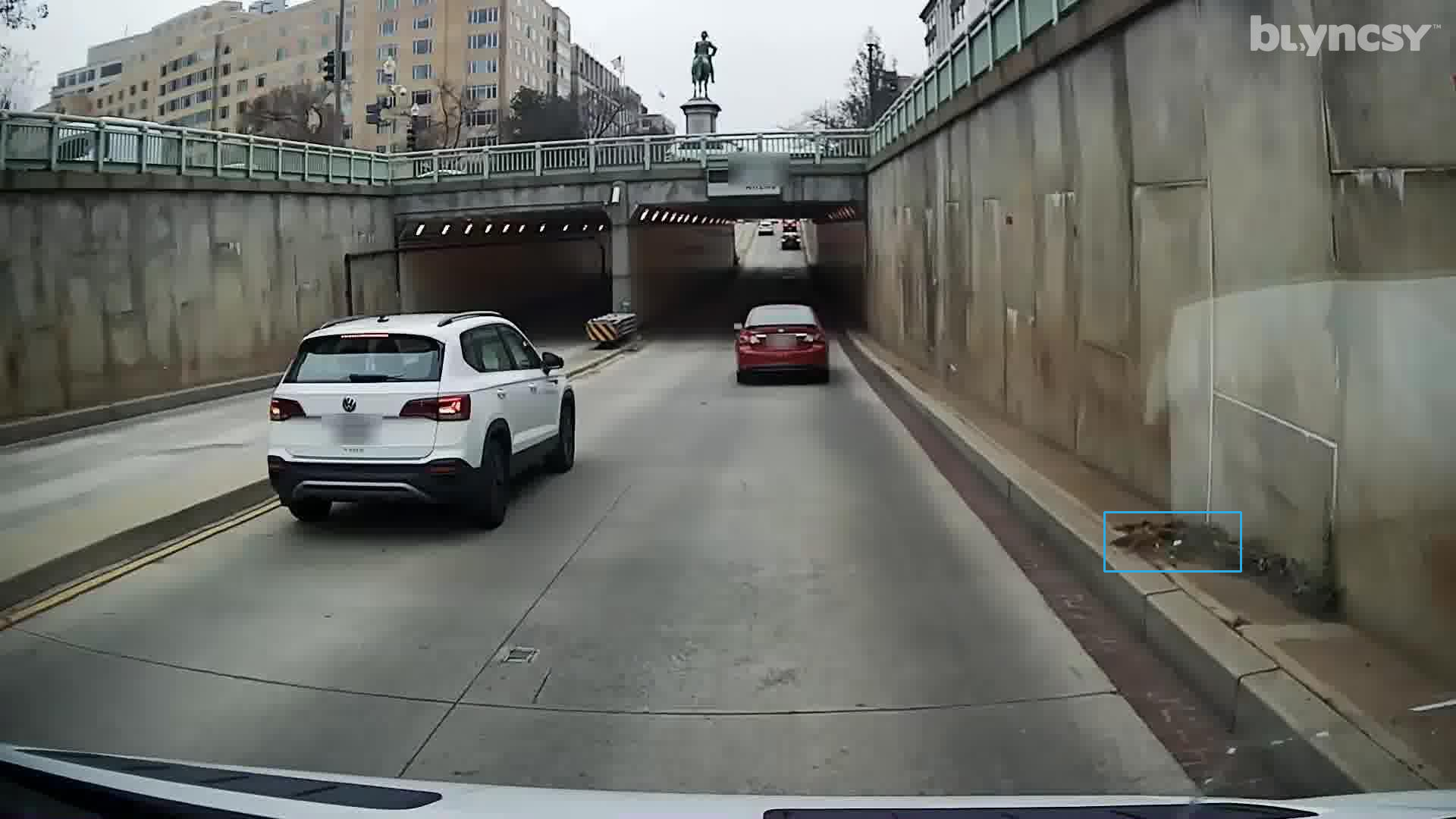
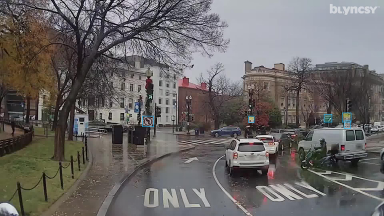
Blyncsy releases this groundbreaking public safety map highlighting key road conditions, road sign detection and classification based on MUTCD code, and AI-powered debris detection in Washington, D.C., specifically the areas around the Capitol and Washington Mall.
Utilizing crowdsourced dash camera imagery from over one million vehicles, coupled with Blyncsy’s advanced AI analysis tools, Blyncsy’s technology provides critical insights into road safety conditions, including potholes, cracked pavement, missing signage, guardrail damage and over 40 safety-critical issues. The initiative is designed to support local and federal agencies in prioritizing roadway maintenance while aligning with broader sustainability and equity goals.
“This map gives people a chance to see Washington, D.C. in a whole new way, right at a moment when the world’s attention is on our capital. It’s not just about the inauguration; it’s about using cutting-edge technology to help improve the safety and efficiency of our roadways for everyone, now and in the future.”
Mark Pittman, Founder
Blyncsy
Scroll and zoom in on the map to view individual areas. Select or deselect the layers along the left side menu to view specific detections.
This map was developed for marketing purposes only, and a representation of what is possible when you partner with Blyncsy for roadway management and asset inventory projects of all sizes.
Want to get a custom overview of your managed roads?
Schedule a demo now
Ready to spend more of your time and budget on fixing problems, rather than finding them? Request some time with our team and we’ll walk you through how Blyncsy works, what makes us unique, and why so many local and state transportation agencies are turning to our automated AI technology to create a safer, more efficient, and more equitable transportation network.