See a sample of the condition of your roads and roadside assets
Blyncsy does it differently. We’re democratizing our data collection into a public demo that you can explore our technology for yourself.
While other companies manually drive your roads with their fleet of vehicles, or equip your trucks with cameras, we utilize crowd-sourced imagery to more quickly, safely and accurately inspect your roads, work zones, and roadway assets.
Why is this important? Cities and state DOTs are under increasing pressure to maintain safe road networks while working with limited budgets and resources. Our technology is a fraction of the cost of manual or LiDAR-based inspections, just as accurate, and actionable results can be delivered in near real-time.
Guardrail Inventory
Guardrail Damage
Sign Inventory
MUTCD Sign Classification (10 samples)
Streetlight Outage
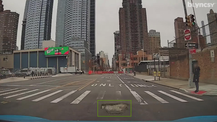
Road Debris
Vegetation Encroachment
Pothole Detection
Impact Attenuator Detection
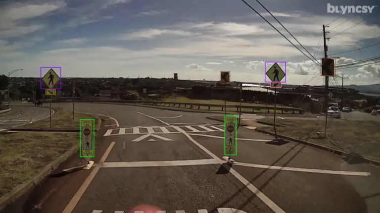
Crosswalk Detection
Scroll and zoom in on the map to view individual areas. Select or deselect the layers along the left side menu to view specific detections.
This map was developed for marketing purposes only, and a representation of what is possible when you partner with Blyncsy for roadway management and asset inventory projects of all sizes.
Want to get a custom overview of your managed roads?
Schedule a Demo
Ready to spend more of your time and budget on fixing problems, rather than finding them? Request some time with our team and we’ll walk you through how Blyncsy works, what makes us unique, and why so many local and state transportation agencies are turning to our automated AI technology to create a safer, more efficient, and more equitable transportation network.