England Roadway Safety and Asset Inventory Detections
Blyncsy empowers transportation agencies around the globe with the ability to monitor—in near real-time—the status of their roads for more informed decision-making.
Blyncsy is Democratizing our Data
Comprehensive public map of current roadway safety and maintenance conditions across England
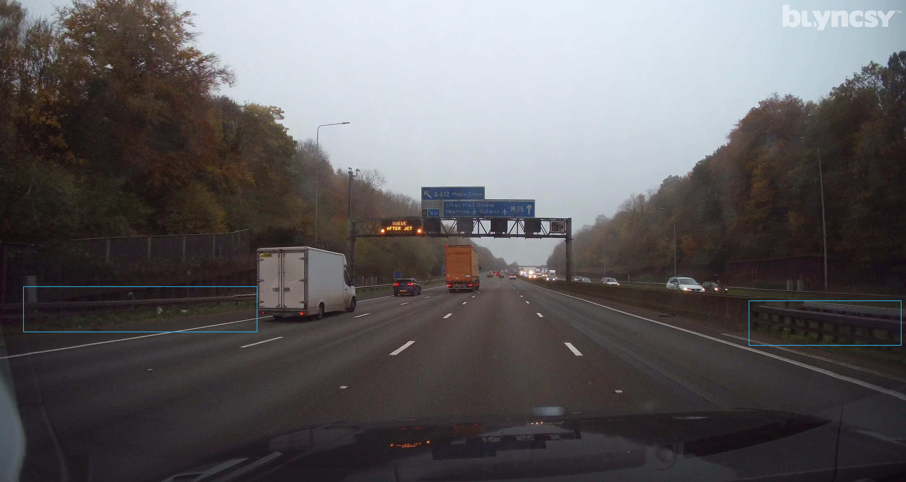
Blyncsy has published a comprehensive public map of Britain showing key roadway assets such as guardrails, road signs, roadside debris detections and vegetation encroachment to support roadway safety and maintenance conditions. This data is now available to all transportation agency officials in Britain, enabling them to better address safety, maintenance, and repair operations of deteriorating and at-risk roads more efficiently and cost-effectively.
The new Blyncsy highway map uses crowdsourced dash camera imagery from over 1 million vehicles in use today coupled with Blyncsy’s powerful AI image analysis toolset to detect over 40 different road conditions and asset inventory issues in near-real time. These issues include potential roadway safety hazards from guardrail damage, missing signage, and lack of proper road striping to roadway vulnerabilities from crashes, natural disasters, and work zone areas.
Blyncsy’s AI-powered crowdsourced data is delivered through an open API, providing transportation agencies a solution that is infinitely scalable and more cost-efficient when compared to other manual data collection technologies like LiDAR, or traditional road inspection methods, which require road maintenance crews to be dispatched.
Scroll and zoom in on the map to view individual areas. Select or deselect the layers along the left side menu to view specific detections.
This map was developed for marketing purposes only, and a representation of what is possible when you partner with Blyncsy for roadway management and asset inventory projects of all sizes.
Copyright ©2024 Blyncsy, Inc. A Bentley Systems Company.
Blyncsy
Comparison
Competition
Want to get a custom overview of your managed roads?
Schedule a Demo
Ready to spend more of your time and budget on fixing problems, rather than finding them? Request some time with our team and we’ll walk you through how Blyncsy works, what makes us unique, and why so many local and state transportation agencies are turning to our automated AI technology to create a safer, more efficient, and more equitable transportation network.

