Partnership helps transportation agencies identify roadway issues faster, track infrastructure changes over time, and improve public safety
EXTON, Pa., November 18, 2025 — Bentley Systems, Incorporated (Nasdaq: BSY), the infrastructure engineering software company, announced today an expanded partnership with Google by adding Google Street View and LiDAR data to its roadway analytics solution, Blyncsy. The combination of Bentley and Google enables transportation departments to eliminate costly manual inspections and automate critical roadway maintenance activities.
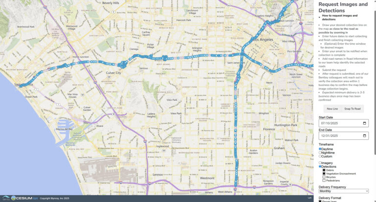
The collaboration creates a unique, industry-first combination of Google Street View, Google Vertex AI, and Blyncsy roadway analytics to help transportation agencies quickly identify problems. Currently, Blyncsy applies analytics to crowdsourced imagery of roadways networks, allowing remote and automated inspections and asset inventories. Adding Google Street View extends these capabilities to rural and other underserved regions worldwide and enables transportation agencies to conduct damage assessments based on historical data to accelerate routine maintenance and disaster recovery.
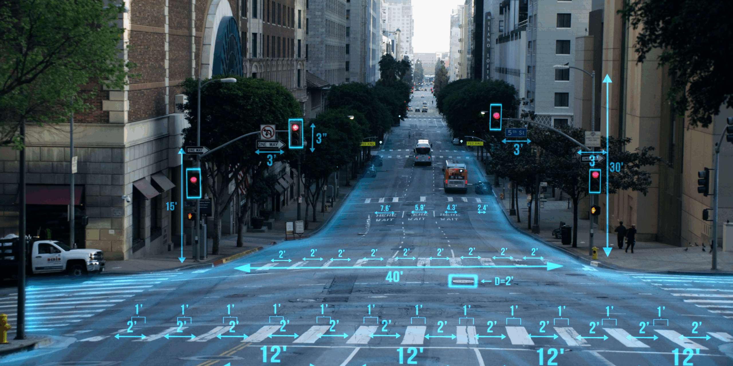
Bentley will also add Google LiDAR data to Blyncsy, delivering inspection-grade analysis at roughly half the cost of traditional methods. With precise depth, dimension, and distance measurements, engineers can better assess and detect guardrail damage, pavement cracks, and other concerns. With post-processed, inspection-grade LiDAR data as a service, agencies gain unmatched detail and cost-effective insights. Google Street View and LiDAR data will be generally available in Blyncsy in early 2026.
“By making advanced data and AI accessible to transportation authorities, Bentley and Google are transforming how the world manages its roadway infrastructure,” said Mark Pittman, senior director of Transportation AI at Bentley Systems. “Replacing cumbersome and expensive geometric data collection with on-demand data and AI-powered analytics cuts costs and reduces access time from months to minutes. With the combined capabilities of Blyncsy and Google, agencies can transform operations and maintenance on a global scale.”
“Understanding the state of physical infrastructure is critically important. However, infrastructure owners face significant hurdles—from high inspection costs to challenges in scaling remote sensing capabilities,” said NAME, Google. “By further expanding our relationship with Bentley, infrastructure professionals can unlock the full potential of data and roadways analytics to overcome these limitations. By combining Google Street View and LiDAR with Bentley’s Blyncsy solution, we can help governments and transportation agencies deliver safer, smarter, and more resilient infrastructure for everyone.”
About Bentley Systems
Around the world, infrastructure professionals rely on software from Bentley Systems to help them design, build, and operate better and more resilient infrastructure for transportation, water, energy, cities, and more. Founded in 1984 by engineers for engineers, Bentley is the partner of choice for engineering firms and owner-operators worldwide, with software that spans engineering disciplines, industry sectors, and all phases of the infrastructure lifecycle. Through our digital twin solutions, we help infrastructure professionals unlock the value of their data to transform project delivery and asset performance.