United States Interstate Highway System Roadway Safety and Maintenance Conditions
Blyncsy empowers state DOTs with the ability to monitor and compare—in near real-time—the status of any major U.S. highway with their existing data for more informed decision-making.
“It is clear we as an industry need to do more to accelerate the thoughtful implementation of digital infrastructure. Blyncsy is doing our part with the publication of this national digital infrastructure dataset for our State Departments of Transportation, and we look forward to working with other industry leaders to help meet this challenge.
Mark Pittman, Founder
Blyncsy
Blyncsy is Democratizing our Data
Comprehensive public map of current roadway safety and maintenance conditions across all U.S. interstate highways
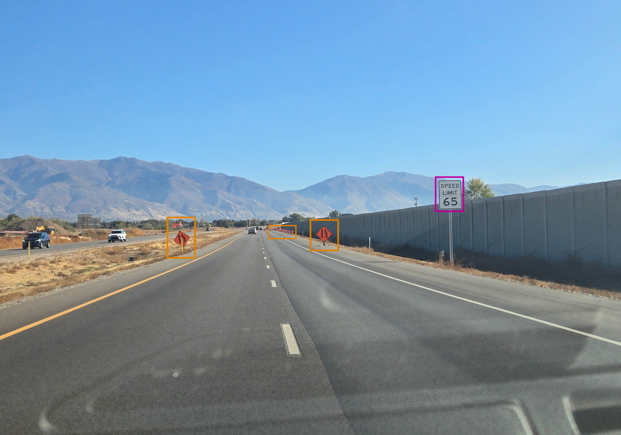
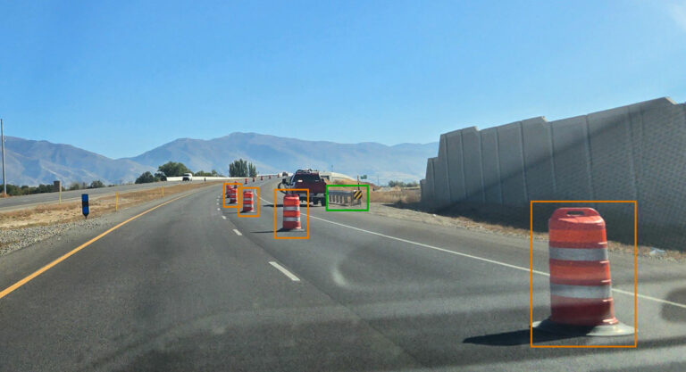
Blyncsy has published a comprehensive public map of all U.S. interstate highways in the continental United States showing key roadway assets such as guardrails, speed limit signs, exit signs, and work zones to support roadway safety and maintenance conditions. This data is now available to all state U.S. Department of Transportation (DOT) agencies, enabling them to better address safety, maintenance, and repair operations of deteriorating and at-risk roads more efficiently and cost-effectively, especially during times of natural disasters.
The new Blyncsy interstate highway map uses crowdsourced dash camera imagery from over 1 million vehicles in use today coupled with Blyncsy’s powerful AI image analysis toolset to detect over 40 different road conditions and asset inventory issues in near-real time. These issues include potential roadway safety hazards from guardrail damage, missing signage, and lack of proper road striping to roadway vulnerabilities from crashes, natural disasters, and work zone areas.
Blyncsy’s AI-powered crowdsourced data is delivered through an open API, providing state DOTs a solution that is infinitely scalable and more cost-efficient when compared to other manual data collection technologies like LiDAR, or traditional road inspection methods, which require road maintenance crews to be dispatched.
“The application of advanced technologies like AI, combined with new sources of data, are transforming the transportation sector, giving us better information as we make investments in safety and mobility. We applaud companies like Blyncsy for deploying these forward-thinking technologies and making this digital infrastructure data available to the public in an accessible format. We’re excited to see how Blyncsy’s data launch will support the core values of safety and equity while furthering the digital infrastructure movement on a national scale.”
Laura Chace, President and CEO
Intelligent Transportation Society of America (ITSA)
Scroll and zoom in on the map to view individual areas. Select or deselect the layers along the left side menu to view specific detections.
This map was developed for marketing purposes only, and a representation of what is possible when you partner with Blyncsy for roadway management and asset inventory projects of all sizes.
Copyright ©2024 Blyncsy, Inc. A Bentley Systems Company.
Blyncsy
Comparison
Competition
Want to get a WMS/WFS link to your state?
Request your data now
Ready to spend more of your time and budget on fixing problems, rather than finding them? Request access to this data feed and we’ll send you a WMS/WFS link so you can compare our data collection to your information. By exploring this data, your team can evaluate the effectiveness and accuracy of your existing road condition assessment and asset inventory procedures compared to Blyncsy’s crowd-sourced, AI-powered system.

