For most government agencies, collecting accurate and comprehensive road condition data is expensive and difficult to scale. The Google and Blyncsy partnership is looking to change that.
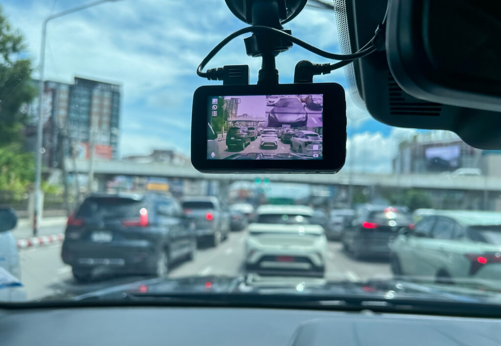
The partnership enables Blynscy users to leverage the crowdsourced dashcam footage and receive full access to the global Google Street View database. This fully functioning system has high-quality data and built-in updates. It will allow government agencies to analyze the roadways within their jurisdiction and ultimately build more effective, efficient repair and replacement plans.
The Google and Blyncsy partnership solves one of the biggest pain points most transportation agencies experience today. Join us for an in-depth look into these challenges and the potential of Google and Street View to address them directly. Also, the power of a partnership with Blyncsy’s AI system to create a better way of consistently monitoring roadway conditions.
The Current Issues With LiDAR Data Collection for Government Agencies
For most transportation agencies, monitoring and maintaining roadway conditions is among their core goals and responsibilities each year. Yet, according to the latest U.S. Infrastructure Report Card, 43% of the nation’s roadways are in poor or mediocre condition, with many worsening as agencies fall short on budget and resources.
That shortage, in turn, closely connects to the difficulty of monitoring road conditions on a scalable and consistent basis. Manual monitoring of every road is not typically feasible, but technology-based solutions tend to fall short.
LiDAR mapping has gained popularity in recent years, presenting a potential solution. But the 3D-mapping solution comes with potentially significant challenges in its own right:
- LiDAR mapping is expensive, with some estimates putting the cost upward of $300 per mile of road. Equipment must be rented, as the average LiDAR-equipped car will be unaffordable for most agency budgets.
- Mapping an entire jurisdiction can take several months. Because it is a point-in-time map, this multi-month process must be repeated regularly for maximum effectiveness.
Most agencies sign contracts with private firms to perform LiDAR mapping on their behalf. This is due to its expense and time-consuming nature. In many cases, because the technology evolves so quickly and the field is so volatile, a private firm risks going out of business before the data collection and analysis is complete, failing to deliver results despite the large investment.
As a result, many agencies that engage with LiDAR regret it in the end. Many others choose against this potential path. Meanwhile, one of the world’s biggest digital companies already has a ready-made solution, ready to be leveraged on a broader scale.
The Power of Google Street View in Collecting Roadway Data
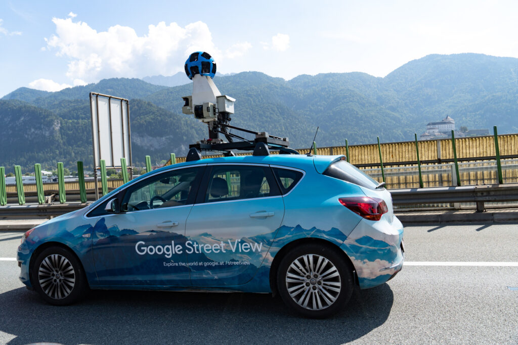
For nearly twenty years, Google has already done what transportation agencies still aim to do. The launch of Street View in 2007 was specifically designed to “create a 360-degree map of the world”—one road at a time. The 18 years since have seen the technology capture and display more than ten million miles of roadways, stitching together more than 220 billion images.
The project was not created with timeliness in mind when it was first launched. However, Google became more efficient in capturing data over time. This includes the ability for external parties to create and upload their images, provided they are using Google-approved equipment for consistency. That, in turn, has enabled Google to guarantee updates for urban areas annually and for rural areas every two to three years.
In Street View, Google has created a publicly known, available, and trusted database of roadways. In a 2022 release celebrating the platform’s 15th anniversary, it announced that it was taking the technology one step further:
“Previously, we needed to create an entirely new camera system whenever we wanted to collect different types of imagery. But now, we can add on to this modular camera with components like lidar — laser scanners — to collect imagery with even more helpful details, like lane markings or potholes. We can add these features when we need them, and remove them when we don’t.”
The same release also announced the ability to “go back in time” by reviewing older images of the same roads. This time capsule is an interesting way for consumers to see how urban and rural environments have changed in the past 18 years. The feature unlocks the potential for transportation agencies to review changing and worsening conditions—at least theoretically.
Reading the above quote and combining it with the time capsule feature makes it easy to see how agencies can take advantage of the vast amount of information collected. But until this year, they had no way of accessing it at scale. Thanks to our partnership with Google, that’s about to change.

The Potential of Combining Google and Blyncsy Data to Drive Better, More Comprehensive Insights
Thanks to the new partnership, Blynscy will receive access to the full Google Street View database. That, in turn, will combine two powerful technologies:
- Google’s high-resolution Street View imagery, available in every market and municipality, combined with the crowdsourced dashcam images collected by Blyncsy.
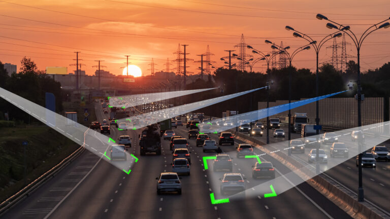
- Blyncsy’s AI system will be able to dynamically analyze the data within pre-set geographic diameters. It will detect potential issues from road damage to potholes and how they change over time.
The footage, combined with the analytics platform, will enable users to compare the baseline of Street View with near real-time imagery to identify changes and issues as they arise. This system is more comprehensive than manual LiDAR surveying firms can accomplish. It also comes at a fraction of the cost of these manual surveys.
The combined technology also has potential implications for disaster recovery. Through comparative imagery, agencies can quickly assess damage specifically caused by natural disasters and build nimble recovery plans in the areas that need it most.
The Google and Blyncsy partnership is a true game changer for transportation agencies looking for (and needing) better ways to assess their roadways regularly and in ways that match their budget. Big things are on the horizon for Blyncsy, and our clients are about to reap the benefits.