The Past, Present, and Future of Roadway Maintenance
Maintaining vast networks of roadways is a constant challenge for transportation agencies. Traditional inspection methods are often time-consuming, costly, and reactive. What if you could anticipate infrastructure issues before they become critical? Blyncsy, in collaboration with Google Cloud, is making this vision a reality.
See how this unique partnership benefits your agency
Our AI platform transforms crowd-sourced imagery into real-time intelligence across your entire road network, helping you make faster, data-driven decisions to improve public safety and optimize your maintenance budget.
Historical Road Analysis
Leverage Google Street View’s archived imagery to track roadway conditions over time and identify developing issues before they become critical.
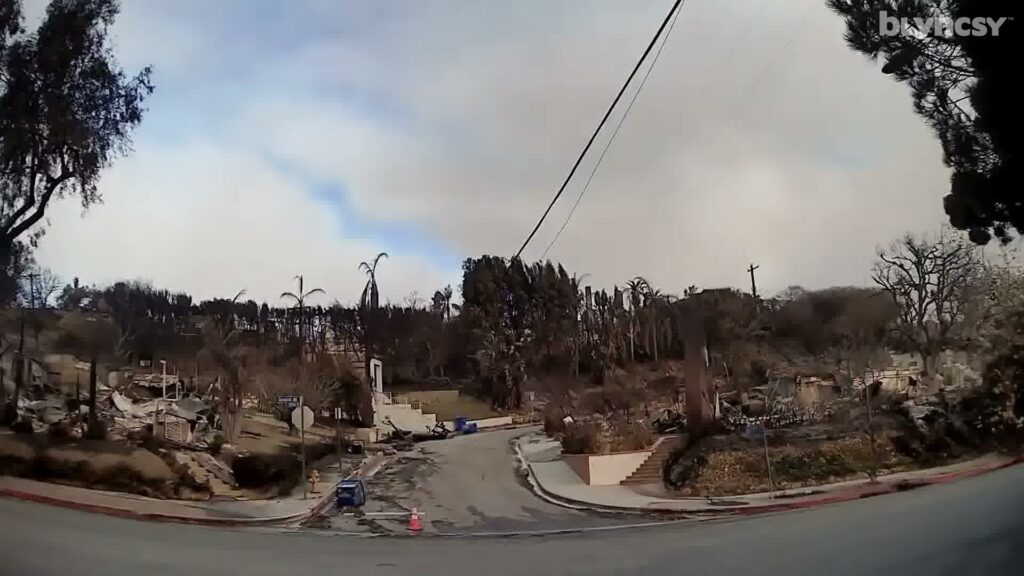
Accelerated Disaster Assessment
Conduct quick and cost-effective damage assessments using AI-analyzed imagery, accelerating disaster recovery and helping communities rebuild faster.
Considerable Cost Savings
Automating your asset inventory and road condition assessments can save you up to 96% compared to traditional manual processes.
“Google’s Street View imagery provides a powerful digital twin of the world’s roadways. We are thrilled to partner with Bentley to unlock the full potential of this data through their advanced asset analytics platform. By combining our global imagery and roadway insights with Blyncsy’s AI-powered solutions, we can help governments and transportation agencies build safer, smarter, and more resilient infrastructure for everyone.”
— Yael Maguire, Vice President of Geo Sustainability, Google
What we Offer
Advanced Solutions to Revolutionize Roadway Management
The Blyncsy and Google collaboration will provide transportation agencies worldwide with unprecedented data and AI-powered analysis to build safer, more resilient infrastructure.
Automated Disaster Recovery
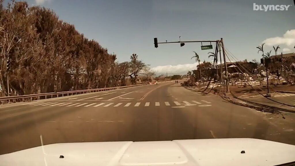
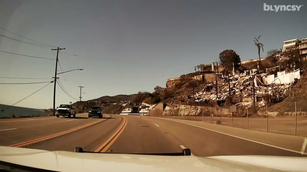
In the wake of natural disasters, rapid damage assessment is crucial for effective recovery. Blyncsy’s new capabilities offer a cost-effective and automated solution for conducting these assessments. By quickly analyzing imagery, agencies can prioritize recovery efforts, access emergency federal and state funding, and help affected communities rebuild faster. This technology is a game-changer for disaster response, enabling quicker and more efficient aid.
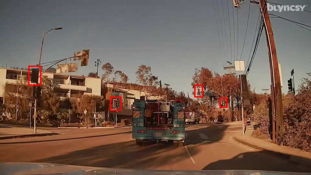
Comprehensive Asset Inventory
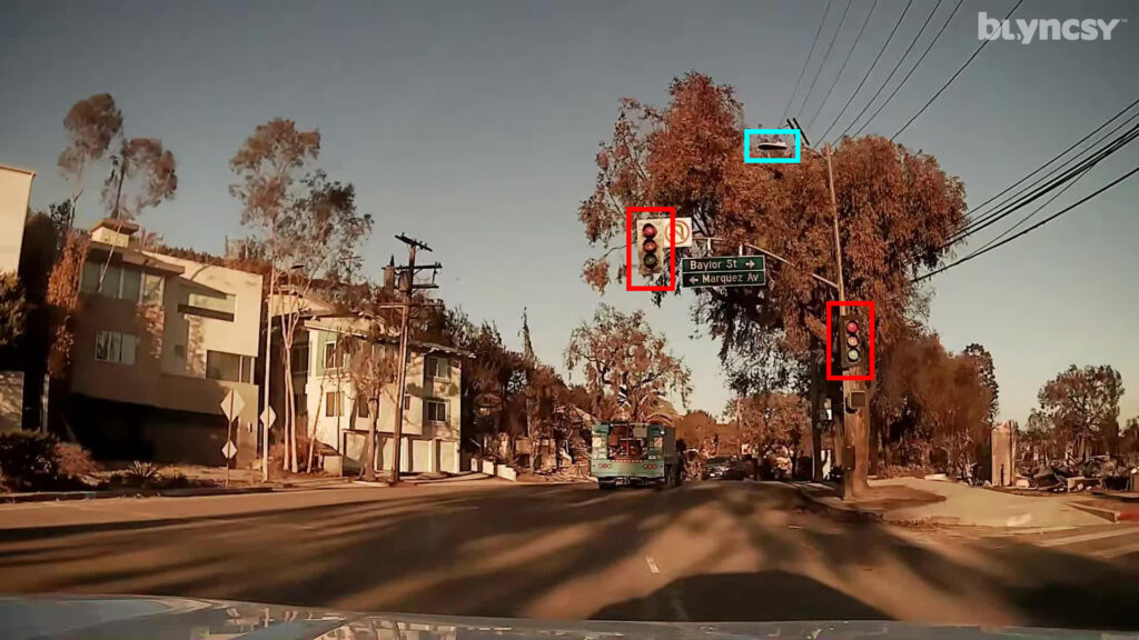
Achieve a complete and accurate inventory of your roadway assets with our advanced system. Using Google Street View’s historical data, we pinpoint the location and condition of all your infrastructure, from signs to storm drains. Combined with real-time updates from Blyncsy dash cameras, you gain unparalleled visibility, enabling proactive maintenance and optimized resource allocation.
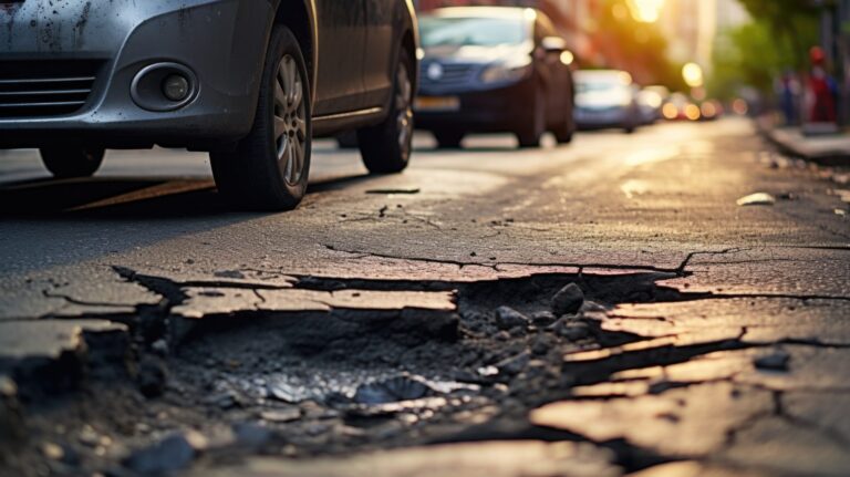
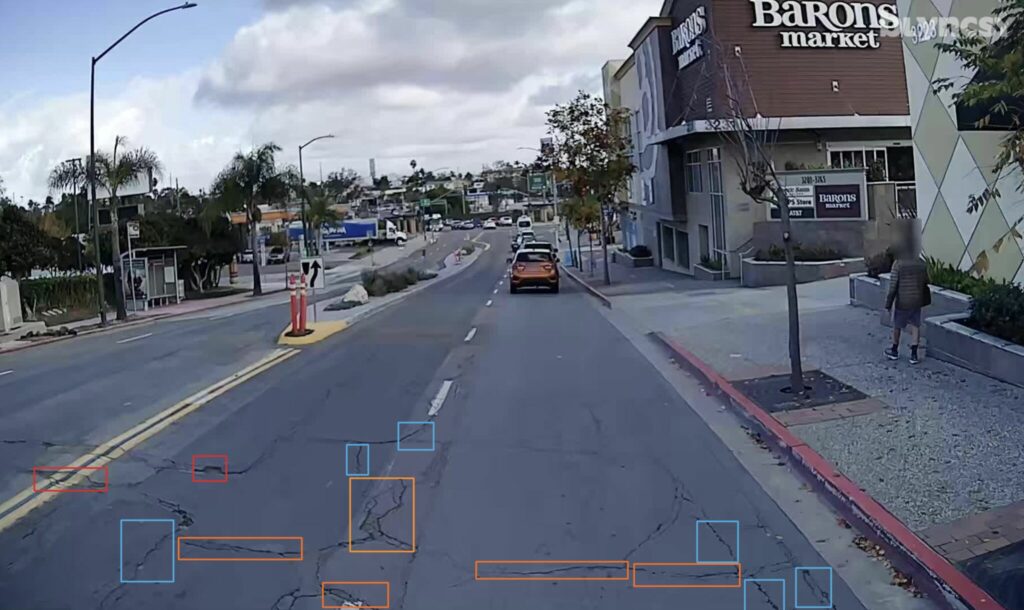
Pavement Degradation Analysis
Identify and address pavement degradation before it escalates with our comprehensive analysis. Leveraging Google Street View’s historical imagery, we track the development of cracks and potholes over time. Supplemented by real-time dash camera data, our system highlights vulnerable areas, allowing you to prioritize repairs, extend pavement lifespan, and minimize costly replacements.
High resolution LiDAR Measurements
Blyncsy will add LiDAR insights to its platform in 2026, utilizing data already collected for Google Street View. This will provide post-processed, survey-grade LiDAR data as a service, allowing agencies to analyze the precise dimensions of roadway assets at approximately 50% of the cost of traditional collection methods.
Three Comprehensive Solutions, One Experienced Provider
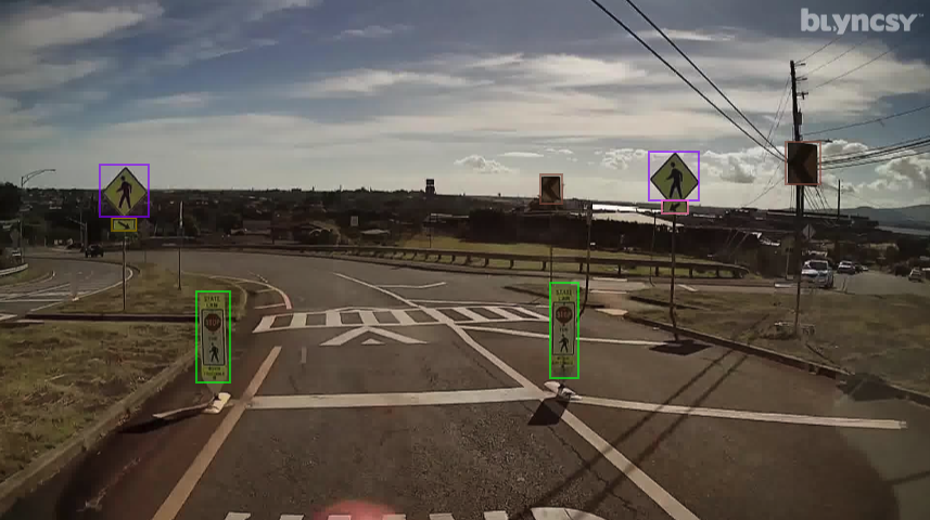
Crosswalks
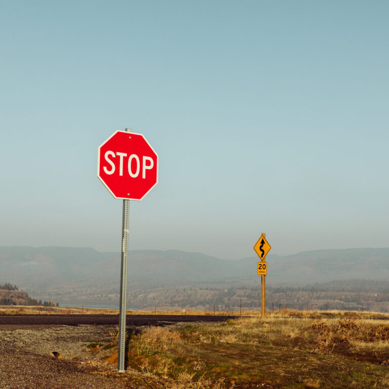
Street Signs
Traffic Signals
Street Lights
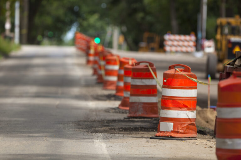
Work Zone Barrels/Cones
Pavement Cracking
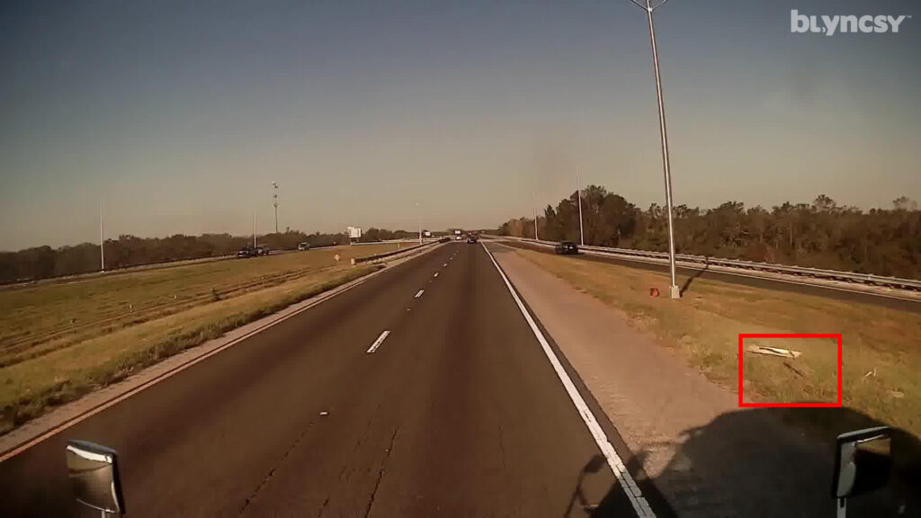
Sewer Covers
Debris
Pedestrian Count
Crosswalks
Street Signs
Traffic Signals
Street Lights
Work Zone Barrels/Cones
Pavement Cracking
Sewer Covers
Debris
Solutions
Rapid Damage Assessment and Access to Emergency Funds
In the wake of natural disasters, rapid damage assessment is crucial for effective recovery. Blyncsy’s new capabilities offer a cost-effective and automated solution for conducting these assessments. By quickly analyzing imagery, agencies can prioritize recovery efforts, access emergency federal and state funding, and help affected communities rebuild faster. This technology is a game-changer for disaster response, enabling quicker and more efficient aid.
Automated asset inventory using historical Google Street View imagery
Automated damage assessment
Quicker access to emergency funding
Keep crews focused on critical recovery and repair efforts
Precise Asset Mapping: Know Every Detail of Your Roadways
Achieve a complete and accurate inventory of your roadway assets with our advanced system. Using Google Street View’s historical data, we pinpoint the location and condition of all your infrastructure, from signs to storm drains. Combined with real-time updates from Blyncsy dash cameras, you gain unparalleled visibility, enabling proactive maintenance and optimized resource allocation.
Pinpoint every asset with Google Street View's historical data
Identify changes and damages over time
Get current asset conditions with Blyncsy's network of crowdsourced dash cameras
Accurate inventory enables efficient resource allocation and proactive upkeep
Identify and address pavement degradation before it escalates with our comprehensive analysis. Leveraging Google Street View’s historical imagery, we track the development of cracks and potholes over time. Supplemented by real-time dash camera data, our system highlights vulnerable areas, allowing you to prioritize repairs, extend pavement lifespan, and minimize costly replacements.
Monitor crack and pothole development over time
Highlight critical areas with real-time dash camera data
Focus resources on the most urgent needs
Proactive analysis reduces costly replacements and extends pavement durability
How it Works
Choose your Area of Interest
Let us know what areas you need to inspect and analyze; from the city limits to targeted areas along your highways.
Choose your Assets to Inspect
From sign inventory to pavement striping conditions, we can utilize the data from Google Street View to catalog and analyze your entire transportation network.
Blyncsy collects the data for analysis
Our AI technology automatically ingests the high-resolution images and analyzes over 40 possible road issues, from pot holes to sign damage, all in near real-time.
You receive actionable insights
Data and insights are delivered to your existing maintenance management system through an open API, so you can generate work orders and start fixing problems immediately.
Disaster Recovery
With the power of Blyncsy AI and Google Street View, we can help you recover more quickly from natural disasters; including hurricanes, wildfires, tornados, earthquakes and flooding. With the ability to look into the past to assess the state of your infrastructure before a disaster, we can automate the process of finding everything that needs to be fixed, letting your crews focus on rebuilding your community.
Ready to Implement Blyncsy x Google Street View for your government agency?
Blyncsy is set to release this new technology globally in late 2025. If you would like to be the first to get access to the Blyncsy x Google Street View service, or you’d like to learn more about getting started with Blyncsy now, please complete the form below and our team will be in touch.