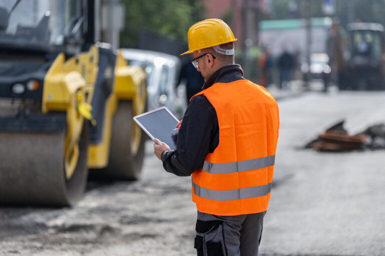
Across the country, state and local transportation agencies face a similar dilemma. This is how to keep roads in good repair when inspection budgets haven’t kept pace with need and aging infrastructure.
The traditional model of sending inspectors or contractors into the field to manually assess assets like pavement, signs, and roadway markings is time-consuming, costly, and incomplete. Too often, it leaves miles of roadway unobserved between inspection cycles. This can span years and open the door for developing issues to worsen before they’re inspected.
At a time when agencies must do more with less, this model no longer aligns with the realities of a modern, data-driven transportation system. A new approach, built on mobile sensor networks, is redefining possibilities for infrastructure monitoring.

The Limits of Traditional Inspections
Manual inspections have long been the standard for roadway asset management. Teams travel road by road, documenting individual conditions and identifying existing or emerging defects. While this method provides detailed information for specific segments, it suffers from two major constraints: coverage and cost.
The Federal Highway Administration (FHWA) notes that local agencies are responsible for roughly 75% of the nation’s road miles, much of it in rural or low-traffic areas. Yet funding and personnel tend to be concentrated in higher-traffic corridors. This means that smaller or remote routes can go years without a proper inspection. When problems finally surface, they often require expensive repairs that could have been prevented through earlier detection mechanisms.
The cost burden is also significant. Manual asset inventories can consume a significant chunk of total maintenance budgets for smaller agencies, driven by labor, vehicle use, and data processing. As a result, agencies often prioritize only a subset of assets for review, leaving gaps in visibility and delaying critical maintenance decisions.
The Rise of Mobile Sensor Networks
Advances in imaging and connectivity are beginning to enable a better model. A mobile sensor network leverages the vehicles already on the road, including agency fleets, transit buses, waste trucks, and even rideshare cars. Each is equipped with a dash camera and other low-cost sensors. This enables them to continuously capture data about pavement, signage, lane markings, and roadside conditions even as they complete their normal routes.
Instead of sending inspectors to every location, agencies receive a constant stream of images and location data from vehicles that are already there. Modern software can then classify, map, and quantify what those sensors see, creating a near-real-time picture of the entire network.
This concept is part of a larger trend in connected infrastructure. The National Academies’ Transportation Research Board (TRB) has highlighted how vehicle-based data collection can provide a scalable foundation for road condition monitoring and performance-based maintenance. By distributing sensing capability across thousands of vehicles, agencies gain higher coverage and frequency without proportional increases in cost.

Cost Efficiency and Scalability
Traditional inspections depend on personnel availability and scheduling, which limits how often your roadway data can be refreshed. Mobile networks, by contrast, scale automatically as vehicles operate. Each mile driven becomes another data point, working toward a more comprehensive and continually updated dataset.
This approach, in turn, can reduce inspection costs dramatically. The American Society of Civil Engineers (ASCE) estimates that early detection and preventive maintenance can cut lifecycle roadway costs in almost half. By detecting surface degradation, vegetation encroachment, and missing signage before these issues evolve into larger failures, a mobile sensor network supports exactly that.
Data collection is constant. Instead of single snapshots taken every few years, agencies can analyze how conditions change month to month or season to season. This temporal resolution, built by an always-on data collection network, is key to shifting from reactive to proactive management.
Turning Observation Into Insights
A network of dash-camera sensors alone doesn’t deliver without intelligent processing behind it. Software platforms capable of analyzing imagery, extracting condition indicators, and integrating results into asset management systems can make that data more actionable.
This technology category, often described as infrastructure intelligence platforms, uses computer vision and location analytics to turn raw footage into usable information. It identifies potholes, fading pavement markings, damaged signs, or debris, while also being able to estimate the severity and rate of deterioration based on recurring observations from the same locations.
Once processed, these insights can feed directly into existing maintenance planning tools, capital improvement programs, or geographic information systems (GIS). Agencies gain the ability to visualize condition scores across the entire network, then prioritize potential interventions based on more objective risk and urgency assessments.

Moving Toward Continuous Network Awareness
With traditional methods, it can take years to develop a complete asset inventory. Once collected, the data immediately begins to age and becomes less usable over time as a result. Mobile sensor networks eliminate that lag. Because data flows continuously, agencies can monitor trends and track the impact of repairs in real-time.
This continuous visibility, in turn, supports better budgeting. Decision-makers can align their resources with the actual conditions of roadway assets, rather than estimates or outdated reports. It also improves safety by identifying emerging hazards more quickly, including anything from new potholes to potentially obstructed signage.
The result is a high-quality feedback loop. Data informs maintenance, maintenance improves conditions, and updated data confirms the outcome. Over time, this builds a more accurate understanding of asset performance and helps to extend the lifespan of roadway infrastructure.
Preparing Transportation Agencies for What’s Next
The U.S. Department of Transportation has emphasized digital transformation as central to efficiency and cost reduction across all transportation programs in its current Strategic Plan. Mobile sensor networks align closely with that goal by taking advantage of the assets agencies already have, their fleets, and turning them into tools for data collection and analysis.
Implementing this approach can start on a smaller scale, with pilot programs using a subset of vehicles before scaling gradually. Blyncsy’s platform can help to streamline that process.
Through Blyncsy, local and state transportation agencies can operationalize their mobile sensor network. By harnessing dash cameras and other connected data sources, it delivers a continuous, high-resolution stream of roadway imagery and condition indicators. The system integrates directly with asset management workflows, helping agencies transition from period inspection cycles to continuous monitoring.
This model demonstrates the broader potential of infrastructure intelligence. It also shows that with the right data, agencies can see more while spending less in their goal to maintain safer, longer-lasting roads.


